
Recreation Map of the San Diego Backcountry: Waterproof, synthetic paper (Tom Harrison Maps)
Product Description
Condition - Very Good
The item shows wear from consistent use but remains in good condition. It may arrive with damaged packaging or be repackaged.
Recreation Map of the San Diego Backcountry: Waterproof, synthetic paper (Tom Harrison Maps)
All maps have color-coded symbols and trails, mileages between trail junctions, latitude/longitude, UTM grids, contour lines, Scale 1:126720 vegetation, and elevations at trail junctions.Tom Harrison Maps is famous for the beauty and accuracy of its maps. All maps printed on waterproof and tear resistant material.Includes Anza Borrego State Park, Cleveland National Forest, Cuyamaca State Park and the Southernmost portion of the Pacific Crest Trail.
Technical Specifications
You might also like

Anza-Borrego Desert Region: Your Complete Guide to the State Park and Adjacent Areas of the Western Colorado Desert

MAP Anza-Borrego Desert Region

Afoot and Afield: San Diego County: 281 Spectacular Outings along the Coast, Foothills, Mountains, and Desert
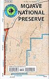
Mojave National Preserve Recreation Map (Tom Harrison Maps)

Joshua Tree National Park (National Geographic Trails Illustrated Map) (National Geographic Trails Illustrated Map (226))

Hiking Anza-Borrego Desert State Park: 25 Day and Overnight Hikes (Regional Hiking Series)

Death Valley National Park Recreation Map (Tom Harrison Maps)

California Desert Byways: 68 of California's Best Backcountry Drives

Guide to California Backroads & 4-Wheel Drive Trails

San Jacinto Wilderness trail map (Tom Harrison Maps)