
Historic Pictoric
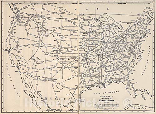
United States Railroad Map 1939 - Rand McNally Historical Map Print - 30in x 24in
Free shipping with 3 or more products in your cart
Alternative sizes, colours, or choices are currently unavailable.
Payflex: Pay in 4 interest-free payments of R709.50. Read the FAQ
R 2,838
In stock
Used, Good Condition
Duties, insurance and VAT included
Delivered in 10–20 working days —



Free shipping with 3 or more products in your cart
Secure checkout
Your payment is fully protected
Duties & VAT included
No surprise charges at the door
Tracked delivery
Track your order end to end
Returns support
30-day return window
Description
Condition - Very Good
The item shows wear from consistent use but remains in good condition. It may arrive with damaged packaging or be repackaged.
- 1939 Rand McNally railroad map showing main line service between leading U.S. cities
- From State Farm road atlas with hotel, cabin camp guide; lithograph in monochrome
- Historical map reproduction ideal for transportation history, railroad enthusiasts, and vintage décor
- FINE ART PRINT QUALITY: Printed on heavyweight 230gsm matte paper with archival giclée inks for crisp detail, rich tonal depth, and long-lasting display quality suitable for home, office, or gallery-style framing.
- PRINTED IN THE USA: Professionally printed on heavyweight matte paper and carefully packaged in a durable protective tube for safe delivery. Many sizes fit widely available standard frames. Each artwork is digitally restored to reduce age-related imperfections while preserving the historic texture, detail, and character of the original map.
Technical Specifications
Manufacturer
Historic Pictoric
Size
76.2 cmL x 61 cmW
Height
0.5 cm
Length
76.2 cm
Width
61 cm
Weight
0.23 kg
Shipping & Delivery
Your order is shipped from the USA and delivered to your door in South Africa in 10–20 working days. All items are fully tracked.
Returns & Exchanges
We offer a 30-day return window. If something isn't right, contact our support team and we'll make it right.