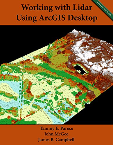
Working with Lidar using ArcGIS Desktop
Product Description
Condition - Very Good
The item shows wear from consistent use but remains in good condition. It may arrive with damaged packaging or be repackaged.
Working with Lidar using ArcGIS Desktop
Lidar imagery provides valuable information in the field of remote sensing, allowing users to determine elevation, vegetation structure, and terrain with remarkable levels of detail. This manual will lead ArcGIS Desktop users through the tools and methods needed to access, process, and analyze lidar data.
Technical Specifications
You might also like
Focusing on Results! Applications Involving LIDAR and Digital Imaging Technologies
GIS Tutorial 2: Spatial Analysis Workbook (GIS Tutorials)

Introduction to Remote Sensing, Fifth Edition (5)

Making Spatial Decisions Using GIS and Lidar: A Workbook

Getting to Know ArcGIS
GIS Research Methods: Incorporating Spatial Perspectives

The Self-Taught Programmer: The Definitive Guide to Programming Professionally
Storytelling with Data: A Data Visualization Guide for Business Professionals

Python for Everybody: Exploring Data in Python 3